Van's Air Force

The definitive Van's Aircraft support community! Buying, building or flying an RV? Join our exclusive family of mentors and enthusiasts!

Garmin G3X Touch Feature Wish List

Feature request: I just saw an FAA notice about AOA where they mentioned the Navy used an AOA system with an audible tone, and I wondered if the G3x system could provide something similar.

Great news, the G3X Touch system has supported audible AOA tones since the very beginning.
Do I need to disable the Stall warn (discrete) if I want to hear the AOA aural tones? I have never hear AOA aural in my flights.. maybe I have to enable them..
 
Great news, the G3X Touch system has supported audible AOA tones since the very beginning.
I tried the Audible AOA tones in the G3X and found them to be terribly distracting. I eventually just turned off all the audible AOA stuff. They would start beeping at the worst possible times when I'm about to roundout to the flare or when already on the runway rolling out in a wheel landing trying to keep it under control with crosswind. It would start beeping like crazy when I was already on the runway.

I have zero against AOA, we flew approaches to landings exclusively by AOA in the Eagle when I was in the USAF and I loved it. But we didn't have audible tones.

YMMV. Definitely try it. But I didn't like it at all.
 
  • Like
Reactions: MED
I tried the Audible AOA tones in the G3X and found them to be terribly distracting. I eventually just turned off all the audible AOA stuff. They would start beeping at the worst possible times when I'm about to roundout to the flare or when already on the runway rolling out in a wheel landing trying to keep it under control with crosswind. It would start beeping like crazy when I was already on the runway.

I have zero against AOA, we flew approaches to landings exclusively by AOA in the Eagle when I was in the USAF and I loved it. But we didn't have audible tones.

YMMV. Definitely try it. But I didn't like it at all.
It sounds to me like your AoA calibration was VERY poorly done! In other posts, you said that you bought your planes - didn’t build and test them…and that is TOTALLY fair! But now that it is yours, consider going and doing a full AoA calibration and then trying it again. I agree that a badly calibrated system is a distraction you don’t need to- but get it set up right, and it is a valuable tool for lower-risk flying. Want to see how easy it is? Here’s a link to a short video:

 
It sounds to me like your AoA calibration was VERY poorly done! In other posts, you said that you bought your planes - didn’t build and test them…and that is TOTALLY fair! But now that it is yours, consider going and doing a full AoA calibration and then trying it again. I agree that a badly calibrated system is a distraction you don’t need to- but get it set up right, and it is a valuable tool for lower-risk flying. Want to see how easy it is? Here’s a link to a short video:

Hmmm, I'll have to go do that again then. I added the G3X system after I bought the 2nd -8, and did the calibration myself. So more than likely I did a poor job as you say. I'll have to go try it again.
 
With Garmin’s Autoland feature making its way to piston singles (SR22), how long before it becomes available to the EAB world?
 
I’d like to see onboard AI analyzing EIS data live with notification of possible problems. Similar to what Savvy is doing with data we upload and pay to have reviewed.
 
With Garmin’s Autoland feature making its way to piston singles (SR22), how long before it becomes available to the EAB world?
Smart glide will get you to an airport.. but the system would need engine control to get you down to a runway. Additional hardware would be required in addition to the software.
 
I’d like to see onboard AI analyzing EIS data live with notification of possible problems. Similar to what Savvy is doing with data we upload and pay to have reviewed.
To add to that, I would like a screen to show trends in flight.. "just noticed Oil temp spiked, lets look at the last 5 minutes, what happened, did it jump up instantaniously? was it a bad sensor?"
 
To add to that, I would like a screen to show trends in flight.. "just noticed Oil temp spiked, lets look at the last 5 minutes, what happened, did it jump up instantaniously? was it a bad sensor?"
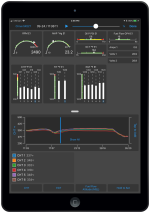
One of the neat features of Garmin Pilot is exactly this -- since it streams the data log to your device, you can graph a number of datapoints from the data log in real time in addition to seeing current values.

1757379741667.png
 
So who is flying the plane while you are analyzing the last five minutes?
just a line chart so you could see where paramaters made major changes, could help.

One of the neat features of Garmin Pilot is exactly this -- since it streams the data log to your device, you can graph a number of datapoints from the data log in real time in addition to seeing current values.
That's exactly what im thinking, didnt know you could do that.
 
To add to that, I would like a screen to show trends in flight.. "just noticed Oil temp spiked, lets look at the last 5 minutes, what happened, did it jump up instantaniously? was it a bad sensor?"
Yes! AI might be able to give us a much more refined answer than just an idiot light. Maybe a concise CAS alert and for more information you could select it if you want or have time. I can see AI being able to tell the difference between a minor problem and a probable impending failure. Just like we’ve gone from a single CHT probe to every cylinder probes to dynamic gauge logic.
 
The G3X (And actually, the G1000 too) hide the ground track pointer as it moves under the heading bug and the current heading pointer. I can't believe this is actually intended behavior, because it means that a indicator which is giving valid information can be completely hidden just because it is a close to an arbitrary value (the heading bug).

Right now, as my RV is being completed, I primarily fly my PA28 with an Aspen panel. Their ground track pointer is easy to see and at an appropriate Z position on the display to remain visible as it moves around.

This point addresses the same thing, but without a response: https://vansairforce.net/threads/ga...2-now-available-9-9-2020.186686/#post-1461371

I understand that in the G3X world, you "should" be using pathways to navigate, but I actually find it much less workload intensive to just use altitude and to align the hsi bearing pointer and CDI with the track pointer. I find it frustrating to need to look for the ground track pointer to be hidden if it happens to be stepped on by the heading bug or the heading pointer. In fact, I actually find it mildly disorienting to look away and back at the PFD to find the track pointer suddenly hidden.

@g3xpert is there anything Garmin can do about this? It's my single biggest gripe with the Garmin HSI.

 
The G3X (And actually, the G1000 too) hide the ground track pointer as it moves under the heading bug and the current heading pointer. I can't believe this is actually intended behavior, because it means that a indicator which is giving valid information can be completely hidden just because it is a close to an arbitrary value (the heading bug).

Right now, as my RV is being completed, I primarily fly my PA28 with an Aspen panel. Their ground track pointer is easy to see and at an appropriate Z position on the display to remain visible as it moves around.

This point addresses the same thing, but without a response: https://vansairforce.net/threads/ga...2-now-available-9-9-2020.186686/#post-1461371

I understand that in the G3X world, you "should" be using pathways to navigate, but I actually find it much less workload intensive to just use altitude and to align the hsi bearing pointer and CDI with the track pointer. I find it frustrating to need to look for the ground track pointer to be hidden if it happens to be stepped on by the heading bug or the heading pointer. In fact, I actually find it mildly disorienting to look away and back at the PFD to find the track pointer suddenly hidden.

@g3xpert is there anything Garmin can do about this? It's my single biggest gripe with the Garmin HSI.

Not to minimize your request, but an option is the track line on the map. My map is set up for track up and it paints a long line on the map indicating my current track. If that is either on top of or parallel to the displayed course line, then I am on the correct track. I don't think I have ever used the HSI, just the map and the CDI scales. That said, I learned on glass, so have no past comfort with HSI's and fully understand how others may prefer it. I do sometimes use the displayed track number at the top of the map when flying approaches, as I find the HSI difficult to be precise with. Just something that may help you here.
 
Would be nice to have the ability to touch one of the data blocks and have it switch to another function. For example, touch the ETA and have it switch to ETE. This would effectively double the number of data fields available. This would be helpful especially when the number of data blocks gets reduced when things like comm and transponder fields are turn on.

Second wish item would be to have the option for distance markers on the map. The scale on the bottom doesn't really give good situational awareness. A tick halfway up the map that displayed 10nm or 40nm would be useful.

Lastly, have a TOD marker on the course line to help visually confirm where the top of descent will occur. I don't really like waiting until on minute prior for the glide slope needle to pop up. I frequently set way points with vnav crossing point to clear things like outer rings of airspace. It would be nice to have a visual backup on the map to verify that the TOD will occur prior to the airspace and that I have allowed enough time and distance to make the descent.
 
Under the Vertical Power tab in the EIS Configuration Input Configuration have the ability to have a custom name rather than the 2 choices we have now for Volts 1, Volts 2, Amps 1 and Amps 2.
 
Volumes.... I wish I could adjust the various mixer inputs in a real environment. Doing it on the ground when it is quiet makes it an iterative process over a longish period of time with a notebook to remember....
 
I wish Garmin would fix the Control Wheel Steering (CWS) function they broke sometime in early '25/late '24 with a firmware update. Coming up on over a year. I know not many folks use it, but frustrating to have functionality that is nerf'd via firmware update that isn't fixed in a timely manner.
 
I wish Garmin would fix the Control Wheel Steering (CWS) function they broke sometime in early '25/late '24 with a firmware update. Coming up on over a year. I know not many folks use it, but frustrating to have functionality that is nerf'd via firmware update that isn't fixed in a timely manner.
I use CWS frequently, have for years -- currently using 9.52. What issue are you experiencing?
 
Lastly, have a TOD marker on the course line to help visually confirm where the top of descent will occur. I don't really like waiting until on minute prior for the glide slope needle to pop up. I frequently set way points with vnav crossing point to clear things like outer rings of airspace. It would be nice to have a visual backup on the map to verify that the TOD will occur prior to the airspace and that I have allowed enough time and distance to make the descent.

I think they added this in 8.91. I am using VNAV with an external navigator - GTN 650xi, and I see TOD, BOD, and I get the "Vertical Track" audible warning at the 1 minute mark.
 
I think they added this in 8.91. I am using VNAV with an external navigator - GTN 650xi, and I see TOD, BOD, and I get the "Vertical Track" audible warning at the 1 minute mark.
Agreed, this seems to be working now but a minute seems to be to long for me to remember to reduce throttle for the decent. :(:rolleyes: How about "Vertical Track Now" audible at TOD? or "Are you sure you want to exceed Vne" as we start down. :cry:
 
Agreed, this seems to be working now but a minute seems to be to long for me to remember to reduce throttle for the decent. :(:rolleyes: How about "Vertical Track Now" audible at TOD? or "Are you sure you want to exceed Vne" as we start down. :cry:

Wouldn’t it be fun to be able to have custom alert sound bites?

For exceeding Vne you could have “Danger Will Robinson!”
 
Agreed, this seems to be working now but a minute seems to be to long for me to remember to reduce throttle for the decent. :(:rolleyes: How about "Vertical Track Now" audible at TOD? or "Are you sure you want to exceed Vne" as we start down. :cry:
BTW you can change the preprogrammed default 3% slope in the GTN to anything you want as a default. (I use 2% and that gives me ~500 fpm)
 
Two requests for Vertical Speed:
1) Display vertical feet per nautical mile (in addition to FPM)
2) on the "pseudo-dials for steam-gauge die-hards" version of the screen, allow adjusting the range of VS, so it doesn't peg out at just 1000 FPM
 
Timer start "button" on the man screen somewhere, so you don't have to go into the menus to restart a timer. As an option.
 
Display vertical feet per nautical mile (in addition to FPM)

You can configure one of the data fields at the top of the screen to display climb gradient, which can be either percent or feet per nautical mile.

Timer start "button" on the man screen somewhere, so you don't have to go into the menus to restart a timer. As an option.

You can simply touch the Timer data field at the bottom of the screen, and you can also optionally add a Timer button to the top of the screen.
 
You can configure one of the data fields at the top of the screen to display climb gradient, which can be either percent or feet per nautical mile.


You can simply touch the Timer data field at the bottom of the screen, and you can also optionally add a Timer button to the top of the screen.
Or install and configure a physical push button to operate the timer.
 
You can configure one of the data fields at the top of the screen to display climb gradient, which can be either percent or feet per nautical mile.


You can simply touch the Timer data field at the bottom of the screen, and you can also optionally add a Timer button to the top of the screen.
Thanks Matt! Good to know.
 
I use CWS frequently, have for years -- currently using 9.52. What issue are you experiencing?
CWS by design is supposed to hold whatever pitch/attitude the plane is at when the CWS/AP Disc button is released. It did that for years. Now it rolls wings level. Fail.
 
One of the things I would like to see with the advent and ability to bring your own wi-fi to the plane via starlink is G3X showing more realtime weather on the display with better wind forecast.
  • ADSB & Internet based weather radar, wind, icing
  • Over the air software and database updates
  • Internet based Notams
With the G3X I rarely use foreflight during the flight I really only use for flight planning.... A more seamless link between the panel and my phone/tablet via wi-fi may actually get me to switch to Garmin Pilot....?????
 
With Garmin’s Autoland feature making its way to piston singles (SR22), how long before it becomes available to the EAB world?
I've never understood the desire for AUTOLAND in a GA airplane unless you're using it for work and absolutely need to shoot approaches in the WX down to 0/0 to get somewhere. Especially an RV. I bought my RV so I could FLY it. Sure I use the AP on long XCs, but if you have Autoland I just think it takes away the entire point of why you have the airplane in the first place. I also fear its one more automation tool that just adds to complacency. Sure, for an emergency when the husband (or wife) pilot strokes out or passes out and the spouse/pax doesn't know how to fly - its great. But I fear too many will use it as a crutch in non-emergency situations.

YMMV.
 
I've never understood the desire for AUTOLAND in a GA airplane unless you're using it for work and absolutely need to shoot approaches in the WX down to 0/0 to get somewhere. Especially an RV. I bought my RV so I could FLY it. Sure I use the AP on long XCs, but if you have Autoland I just think it takes away the entire point of why you have the airplane in the first place. I also fear its one more automation tool that just adds to complacency. Sure, for an emergency when the husband (or wife) pilot strokes out or passes out and the spouse/pax doesn't know how to fly - its great. But I fear too many will use it as a crutch in non-emergency situations.

YMMV.
Garmin's Emergency Autoland system is designed for emergency use only. That emergency is that the pilot is incapable of completing the flight safely, or believes (s)he may not be able to complete it safely. It is not intended to be used for normal flying, and will most likley land someplace other than you intended. It is not certified for normal use. It is designed so that if it is used, you can expect to be contacted by the FAA and asked why you used it.
 
Garmin's Emergency Autoland system is designed for emergency use only. That emergency is that the pilot is incapable of completing the flight safely, or believes (s)he may not be able to complete it safely. It is not intended to be used for normal flying, and will most likley land someplace other than you intended. It is not certified for normal use. It is designed so that if it is used, you can expect to be contacted by the FAA and asked why you used it.
Ok, that makes me feel much better for the intended scope of it then. I have some first hand experience with Auto Takeoff and Land (ATLS) systems in the USAF. While the system works great (when it works) - I noticed an almost immediate sense of complacency among both the instructors and students once they used it enough to trust it. Their mindset was "I'm just going to do the absolute min manual landings required for currency" and they used the ATLS most of the rest of the time. The problem is it had lower XW limits than allowed manually landing the jet and couldn't handle a true emergency like an engine fail. So when the pilot was required to deal with the hardest situation, many were at their lowest proficiency.
 
Show (maybe timing manage) PMAG data.
With what I know about Garmin and what I know about the inner workings of the P-Mag's serial protocol, I doubt Garmin will ever endorse any connection between the two. That being said, it would be trivial to create a gateway box out of an Arduino or other micro controller to convert the digital data into an analog signal. Then one could create a custom gauge on the G3X to display the variable.
 
Just tried to get to the software page to see if Garmin had finally patched the CWS failure with some new firmware after over a year. It looks like the page is deleted/moved. Maybe they're "upgrading" to a pay service for us experimental guys so we can be just like certified? The lack of support presence from Garmin this last year has been quite noticeable.

Fitz
 
With this thread getting as long as it is, I'm guessing many of the items on the "Wish List" are starting over. In my case, I'd like to see two things:
  • A discrete output that would allow a relay to get turned on or off (switch). Example: while it's not going to happen now, it would have been nice to be able to run a relay to turn on/off Starlink power without adding a physical switch.
  • I'd like to have the ability to change the sizes of some of the boxes. Example: Frequency/flip-flop boxes. Even with the bezel, those things can be tough to hit in turbulence.
 
G5 as PFD with G3X as MFD mode

I would like the ability to configure my G3X in MFD mode since I use a G5 as my PFD. This allows me to split screen MAPS and Traffic/Engine/Waypoint info, etc.

Similar to the Dynon where you can set map as the priority, and the PFD screen is one of your selectable choices.

The G3X should see my G5, and allow itself to be configured as a MFD while GSU 25 is enabled, and enter reversionary mode if the G5 fails. I currently disable my ADAHRS so my G3X boots as a MFD. But now I have $1,800 of equipment dead weight I can’t access, all because I want ultimate situational awareness.

Benefits-
Access to second AHRS - redundancy

Access to maximum information. Entering busy airspace I can have PFD via G5 and split screen Map and Traffic page. If I need to change frequency, I don’t have to scroll away from map.

Still have access to PFD page, with map persisting as a split screen.

Cons - none

The G3X fullscreen PFD page with the little boxes for map and traffic are too small after having the G3X in MFD mode and the clearer picture the split screen provides.

Please Garmin, let us do what Dynon can do. Let us fly safer with more situational awareness instead of limiting what pages we can see simultaneously if we have a G5 as our PFD.

The G5 is a fantastic PFD.
 
Add a programable COUNTDOWN function (universal reminder) next to the timer in the bottom of the screen.
User shall be able to program T- ( -mm:ss ) (minutes:seconds)
1. Digits turn green, once countdown has been started
2. When countdown is over, digits flash and turn white, (complemented with optional audio message/tone)


CNTDWN.JPG
 
DISCRETE INPUTS with Advanced Configuration

Add an option to trigger a caution or alert message on CAS without MASTER WARN or MASTER CAUTION.

Example:
1. CAS (yellow) message PARK BRAKE only (no alert / no MASTER CAUTION) from 0 to 1600 RPM
2. CAS (red) message PARK BRAKE + alert* (MASTER WARN) from 1600 RPM upwards

Similar to the 'Canopy Closed' logic described on page 30-213 - G3X Touch Install Manual, Rev AW
 
Last edited:
Back
Top