The 2017 Oregon eclipse had airports packed and tiedown spots hard to find. I dont know Texas but assume the same thing will apply, if not already.
I plan to 'fly the shadow'. Go from CA to somewhere nearby for overnight, then flyout and take the shadow course heading for the viewing.
Did that in 2017 and the view from 10K feet is amazing. You can see the black blob come and go, and see light on the horizon on each side.
Plus, getting out of the area after the show is easy.
Only downside is not hanging with a crowd of others that are freaking out and enjoying the experience.
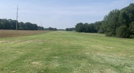
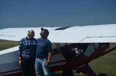
'ArlingtonRV' and I did something similar for the 2017 Oregon eclipse. Me in my RV-8 and 'ArlingtonRV' in his Glasair Sportsman decided to view it from the air. So we both took off from Arlington Airport (KAWO) at 8:30 in the morning, just as the fog was burning off (luckily it burned off just in time!). Siletz Bay is right on the Oregon coast and on the track of the center of totality. We planned to arrive at Siletz Bay at about 9:55 and loiter there until totality started at 10:16 and then fly down the track of the center of totality.
As we flew past Portland a lot of pilots were contacting Portland Approach for Flight Following, but their canned response was something like "Unable Flight Following. Caution: many aircraft all quadrants at all altitudes"!
I figured some other folks would also be viewing it from the air, so I planned to be at 10,500'. I thought I would be above most of the General Aviation traffic at that altitude. I got in the area at 10,500' and there was a crapload of airplanes in the area. So I climbed to 12,500', and there was still a lot of airplanes there too! So I climbed to 13,500' and viewed it from there. I could see contrails of many jets far above me also.
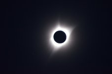
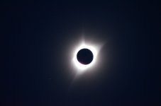
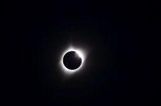
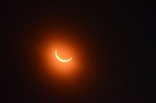
It was pretty cool as it got dark! I had to turn on the instrument lights and navigation lights (already had the anti-collision strobe lights on). And I could clearly see the Sun’s corona during totality (through solar glasses). But it was over very quickly, as totality was only a little more than 2 minutes.
I didn’t get any good pictures of the eclipse, but here are a few screenshots from my iPad during the flight which shows some of the traffic. Only traffic within a 15 NM radius and +/- 3500 feet of my airplane is shown. There was more traffic below and above that altitude, and outside 15 miles.
Coming up on Siletz Bay at 10,500'. Too much traffic, so I climbed to 13,500', where there was less traffic, but still some to contend with.

Heading back and going to Chehalis to refuel and get lunch. Note all of the Washington State airplanes heading back North too, west of Hillsboro (KHIO) and southwest of Scappoose (KSPB).

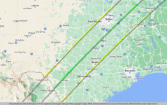
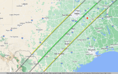
And here is the GPS track I flew with the eclipse boundaries plotted:

And here is a 4 minute video 'ArlingtonRV' took with a GoPro camera mounted on the left wing strut of his Glasair Sportsman. It is the eclipse from just before totality to just after. It's played back at 1.5 times real time. Note the lights coming on, on the ground as it gets dark.
Too cool!