I debated on whether to share this. I really just want to bury this in the recesses of my brain and experience tool box. It's not so much a bruise to the ego, as I am angry at myself for getting to this point. But figured if it can save a flat lander who heads west on some windy day, then here goes...
Quick back ground, 99% of my GA flying experience is all east of the Mississippi. Most of my mountainous flying experience is in turbine aircraft with the structure/power/wing loading to make mountainous turbulence a non-issue. I've been doing a little charter flying on the side recently in and around the Sierras, mainly just for the fun of it. I've got the exposure, education, experience that I should've seen this one coming... but didn't.
Our current SOP is to cancel anytime the wind is higher than 25 knots. I had a quick out/in charter to do, literally one hour total. When loading passengers for the flight out, there were thunderstorms in the area moving through however I had a clear path there and back. The storms were never a player, and out here 80% of all the radar returns are virga that dry up above about 9K feet anyway. So we taxi out, and launch. The wind is a stiff 15-20, but nothing unmanageable. However I can see a dust plume rolling towards the airport and the turbulence tells me the upper air is a lot more active than I thought. I should also add this leg requires clearing a mountain range that's at 8700'. Quick hop over going out, nothing worth noting, it was a nice flight. I land, and am curious/concerned with what looked like a gust front (minus precipitation) approaching where we now had to go back too. On the ground about 20 minutes, and I'm calling home to the ASOS every 3-4 minutes when the winds start picking up. By the time my pax show back up for the return leg ASOS is reporting 25G33 but it's only 30 degrees off RWY heading. If it's too bad, I've got a VFR divert with calm wind, not too worried.
Those of you that have been flying small GA (or anything with a thrust to weight ratio of less than 1:1) probably already have this figured out. I should have. I knew instantly when it happened, what was happening. I failed in thinking that through 15 minutes prior.
For you fellow flat landers, quick education time. When air flows over a structure, it creates a wake (duh). Like water down a rocky stream. We interpret that wake as turbulence. When the wind is blowing perpendicular over a mountain range, it goes up the slope, then down the slope. Usually not an event. When it starts blowing hard enough however, it blows up the up wind side, but has too much energy to attach to the leeward side and come back down. This creates a low pressure area on the leeward side, usually at the ridge line level and lower. If the wind blows hard/long enough, you get what is essentially a horizontal tornado.... or rotor. My dad lost a squadron mate on a flight to this phenomenon, it's speculated that it's what killed Steve Fosset.

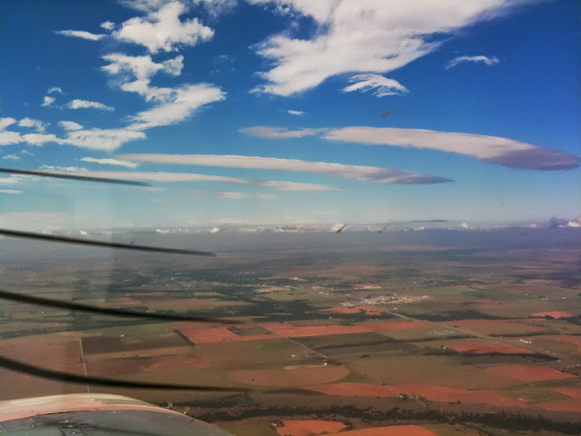
Back to departure for home. There is some dust whipping up here and there, visibility is 50+ (standard out here), light chop, rain showers here and there, uneventful climb to altitude aside from being hot. There is a low spot (or saddle) in the ridge line of this mountain range where we usually cross, today was no different. I was about 1500' above the ridge, headed towards the saddle approaching at about a 30 degree angle, trying to get a look down range and listen to the local ATIS for winds back at the field. Did I fully understand what causes what was about to happen? Yes. Did it ever occur to me to put the current conditions and this knowledge together? Not when it mattered.
Approx 2 miles from crossing, I noticed we started to pick up a decent, which ultimately increased to 2K FPM. This wasn't unusual as even a slight breeze will push you up and down when crossing, but 2K was way more than I'd ever seen. Think of this as mother nature throwing me one last warning which I failed to correlate. Once we had pushed through the down draft, all **** broke loose. In the span of what had to be less than a second, I was thrown against the belts cracking my skull on the roof, and knocking off my headset, over my eyes of all places. Everything that was in the cockpit not tied down was now on the roof. Before I could even react, the airplane was in a 135 degree over bank, in something greater than 20 degrees nose low with airspeed screaming through the yellow arc and a windshield full of rapidly approaching and rising mountains. We were getting beaten so bad I had serious fears of impending structural damage or failure. Having spent many hours upside down in airplanes, the corrective action here came natural thank God, slammed the throttles closed (which set off the gear horn and didn't help with the pax in the back but they are the least of my concerns right now) and with the airplane right side up, pitching up to bleed off airspeed and get back in the green, I still had a 2K FPM decent going (now is when I advocate upset training). Everything went forward against the stops, and I was able to arrest that to 500 FPM. There was a couple of small canyons cutting through the ridge I could settle into and I made a quick assessment. I could over bank away (essentially wingover) and turn back into the valley behind me... and go back through the rotor or I could press forward knowing that once I cleared down draft we'd be clear of the whole thing. I opted to press and pointed us down one of the little canyons. After a few more seconds we were through it, and cleared the ridge with room to spare, given the circumstances. When we got back to the field, it was blowing.... hard. Landed, taxied in, everyone was good. Pax are salty fliers but still said that one scared them. It scared me... bad. The airplane is grounded until a few pieces of the cockpit can be found and all FOD is clear.
Lesson learned here? All the knowledge and experience on the planet doesn't mean squat if you don't recognize when to put it to use. I fully understood what causes the phenomenon. I knew what was happening the moment it happened, I failed to apply any of that in the preceding seconds/minutes/hour leading up. On the way in the pass was totally fine, 20 minutes later on the way out conditions had changed so radically it almost killed us, and only I could've predicted it, you couldn't see it. It wasn't a failure of preflight planning, any willful risk taking, or a violation of any FAR/SOP.... There was no written law or rule that was broken that could've prevented what happened. It was purely a correlation/desicion making failure by me. Back east the only thing that gets in the way of your route can usually be seen in the form of storms/fog/etc. Out here you can see through the dangers, and that's scary. I could've taken a northern route, avoided the entire event and only added about 10 minutes to our flying time but I was so preoccupied with what was going on back at the field and planning for that contingency I didn't realize that I needed another way home, not just an alternate for home.
So if you're headed out this way, google mountain flying. Or start here...
http://www.aopa.org/Pilot-Resources/Safety-and-Technique/ASF-Weather/ASF-Mountain-Flying
http://www.wildfirelessons.net/documents/FAA_Tips_on_Mountain_Flying.pdf
Density altitude (which was 7600' at the time) isn't the only invisible killer out here.
Quick back ground, 99% of my GA flying experience is all east of the Mississippi. Most of my mountainous flying experience is in turbine aircraft with the structure/power/wing loading to make mountainous turbulence a non-issue. I've been doing a little charter flying on the side recently in and around the Sierras, mainly just for the fun of it. I've got the exposure, education, experience that I should've seen this one coming... but didn't.
Our current SOP is to cancel anytime the wind is higher than 25 knots. I had a quick out/in charter to do, literally one hour total. When loading passengers for the flight out, there were thunderstorms in the area moving through however I had a clear path there and back. The storms were never a player, and out here 80% of all the radar returns are virga that dry up above about 9K feet anyway. So we taxi out, and launch. The wind is a stiff 15-20, but nothing unmanageable. However I can see a dust plume rolling towards the airport and the turbulence tells me the upper air is a lot more active than I thought. I should also add this leg requires clearing a mountain range that's at 8700'. Quick hop over going out, nothing worth noting, it was a nice flight. I land, and am curious/concerned with what looked like a gust front (minus precipitation) approaching where we now had to go back too. On the ground about 20 minutes, and I'm calling home to the ASOS every 3-4 minutes when the winds start picking up. By the time my pax show back up for the return leg ASOS is reporting 25G33 but it's only 30 degrees off RWY heading. If it's too bad, I've got a VFR divert with calm wind, not too worried.
Those of you that have been flying small GA (or anything with a thrust to weight ratio of less than 1:1) probably already have this figured out. I should have. I knew instantly when it happened, what was happening. I failed in thinking that through 15 minutes prior.
For you fellow flat landers, quick education time. When air flows over a structure, it creates a wake (duh). Like water down a rocky stream. We interpret that wake as turbulence. When the wind is blowing perpendicular over a mountain range, it goes up the slope, then down the slope. Usually not an event. When it starts blowing hard enough however, it blows up the up wind side, but has too much energy to attach to the leeward side and come back down. This creates a low pressure area on the leeward side, usually at the ridge line level and lower. If the wind blows hard/long enough, you get what is essentially a horizontal tornado.... or rotor. My dad lost a squadron mate on a flight to this phenomenon, it's speculated that it's what killed Steve Fosset.
Back to departure for home. There is some dust whipping up here and there, visibility is 50+ (standard out here), light chop, rain showers here and there, uneventful climb to altitude aside from being hot. There is a low spot (or saddle) in the ridge line of this mountain range where we usually cross, today was no different. I was about 1500' above the ridge, headed towards the saddle approaching at about a 30 degree angle, trying to get a look down range and listen to the local ATIS for winds back at the field. Did I fully understand what causes what was about to happen? Yes. Did it ever occur to me to put the current conditions and this knowledge together? Not when it mattered.
Approx 2 miles from crossing, I noticed we started to pick up a decent, which ultimately increased to 2K FPM. This wasn't unusual as even a slight breeze will push you up and down when crossing, but 2K was way more than I'd ever seen. Think of this as mother nature throwing me one last warning which I failed to correlate. Once we had pushed through the down draft, all **** broke loose. In the span of what had to be less than a second, I was thrown against the belts cracking my skull on the roof, and knocking off my headset, over my eyes of all places. Everything that was in the cockpit not tied down was now on the roof. Before I could even react, the airplane was in a 135 degree over bank, in something greater than 20 degrees nose low with airspeed screaming through the yellow arc and a windshield full of rapidly approaching and rising mountains. We were getting beaten so bad I had serious fears of impending structural damage or failure. Having spent many hours upside down in airplanes, the corrective action here came natural thank God, slammed the throttles closed (which set off the gear horn and didn't help with the pax in the back but they are the least of my concerns right now) and with the airplane right side up, pitching up to bleed off airspeed and get back in the green, I still had a 2K FPM decent going (now is when I advocate upset training). Everything went forward against the stops, and I was able to arrest that to 500 FPM. There was a couple of small canyons cutting through the ridge I could settle into and I made a quick assessment. I could over bank away (essentially wingover) and turn back into the valley behind me... and go back through the rotor or I could press forward knowing that once I cleared down draft we'd be clear of the whole thing. I opted to press and pointed us down one of the little canyons. After a few more seconds we were through it, and cleared the ridge with room to spare, given the circumstances. When we got back to the field, it was blowing.... hard. Landed, taxied in, everyone was good. Pax are salty fliers but still said that one scared them. It scared me... bad. The airplane is grounded until a few pieces of the cockpit can be found and all FOD is clear.
Lesson learned here? All the knowledge and experience on the planet doesn't mean squat if you don't recognize when to put it to use. I fully understood what causes the phenomenon. I knew what was happening the moment it happened, I failed to apply any of that in the preceding seconds/minutes/hour leading up. On the way in the pass was totally fine, 20 minutes later on the way out conditions had changed so radically it almost killed us, and only I could've predicted it, you couldn't see it. It wasn't a failure of preflight planning, any willful risk taking, or a violation of any FAR/SOP.... There was no written law or rule that was broken that could've prevented what happened. It was purely a correlation/desicion making failure by me. Back east the only thing that gets in the way of your route can usually be seen in the form of storms/fog/etc. Out here you can see through the dangers, and that's scary. I could've taken a northern route, avoided the entire event and only added about 10 minutes to our flying time but I was so preoccupied with what was going on back at the field and planning for that contingency I didn't realize that I needed another way home, not just an alternate for home.
So if you're headed out this way, google mountain flying. Or start here...
http://www.aopa.org/Pilot-Resources/Safety-and-Technique/ASF-Weather/ASF-Mountain-Flying
http://www.wildfirelessons.net/documents/FAA_Tips_on_Mountain_Flying.pdf
Density altitude (which was 7600' at the time) isn't the only invisible killer out here.
Last edited: